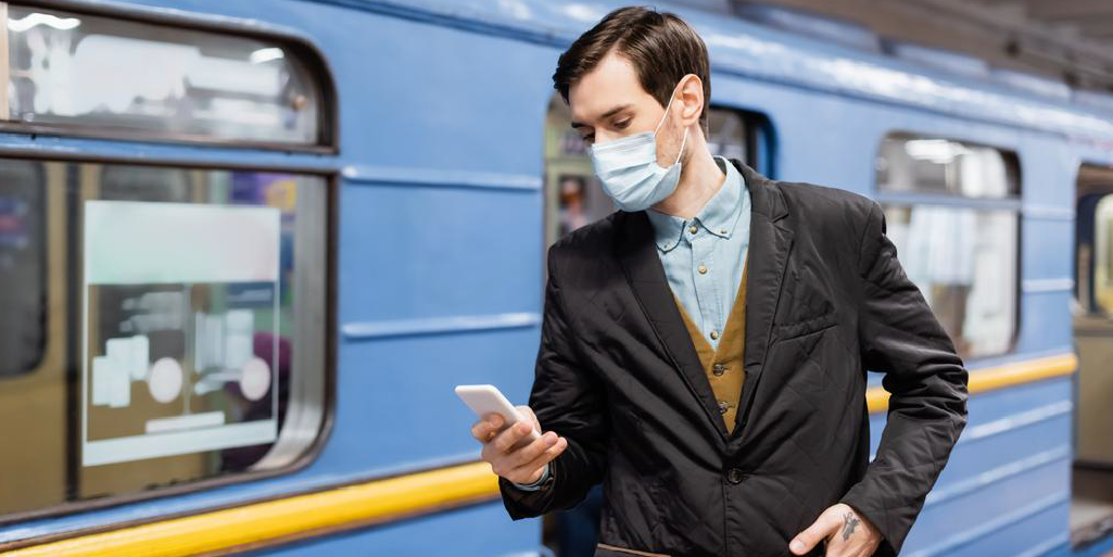
After the notifications reminding the various restrictions related to the crossing of a border, Google Maps has just announced the extension of the coverage of its feature indicating the crowding of public transport. Launched in June 2019, this forecasting tool has become indispensable in this period of the pandemic, where “safety remains top of mind”.
Avoiding crowded public transit
In its blog post, the Montain View company recently announced the deployment of its feature in 100 countries around the world. Accessible to all its users taking the bus, train, tramway or subway. “With this information, you can decide whether you want to hop on board or wait for another train. Because pandemic or not, no one likes standing in a jam-packed subway car”, says the Californian group.
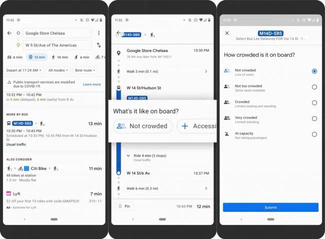
Predictions made possible through “AI technology, contributions from people using Google Maps, and historical location trends that predict future crowdedness levels for transit lines all over the world.” To which Google says that all the data collected is obviously anonymized and not stored. “All these predictions were designed with privacy in mind. We apply world-class anonymization technology and differential privacy techniques to Location History data to make sure your data remains secure and private” the group ensures.
An even more advanced feature in New York and Sydney
With “the cities of New York, Atlanta, San Francisco, Boston and Washington DC leading the pack as some cities with the most crowded lines.”, it was important for the Californian firm to provide even more details.
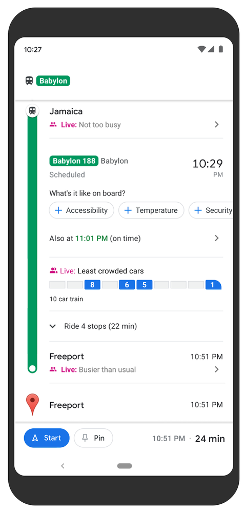
In the cities of New York and Sydney, Google goes even further, providing real-time information on the occupancy rate of each car on the train. This data is supplied by local transit operators such as Long Island Rail Road and Transport for New South Wales.
In addition, Google has also announced the launch of a new tool that allows users to access their travel history, as users who have activated the geolocation history will be able to see their monthly trends. From the modes of transportation used to the distance travelled, to the time spent in different places. For example, restaurants, stores and airports.